
Finding Residents Along a Lakewood Street
The address angle starts with normalization. Write the house number, directional, street name, street type, unit, city, and ZIP exactly as the portal expects. Keep common historical spellings separate from the modern form. The same street can return different results when a direction or type is omitted, and an old directory may use a locality label that predates Lakewood.
Walk the record trail in order. The goal is not a bulk list of names. It is a reproducible path from a public address field to the right custodian, with the limit of each record kept visible.
- Run the address in the Jefferson County assessor address search, then save PIN, AIN, owner, situs, mailing, class, and parcel links.
- Open the same parcel in Jeffco jMap and Lakewood eGIS to check adjacent geometry and mapped context.
- Use the legal description, current owner, or reception clue in the Recorder Real Estate Index.
- Check Treasurer, foreclosure, permit, and code records for dated property events.
- For an older household, use DPL Householder or Criss-Cross volumes, then compare a census, tax, obituary, or archive source.
Lakewood Assessor Address Search
The Jefferson County Property Records Search has a dedicated address route. Address Number is a text field. Pre-directional and Street Type are dropdowns. City and Postal Code are also dropdowns, with LAKEWOOD and county options. Unit Number can matter for a multi-unit address. The observed result maximum is 50, so a street-wide search should preserve the result limit and page state rather than claim completeness.
| Number | House number, entered as text. |
|---|---|
| Pre-directional | E, N, NW, S, SE, SW, or W in the observed options. |
| Street name | Name field; use the stored spelling. |
| Street type | Choices include AVE, BLVD, CIR, CT, DR, LN, PKWY, RD, ST, TER, TRL, and WAY. |
| Unit | Optional text field for an apartment or suite identifier. |
| City and ZIP | Required dropdowns observed for Lakewood and county postal choices. |
The assessor result grid can show neighborhood name and code, PIN, AIN, TAG, property address, city, postal code, owner, property class, and mailing address. Open the parcel detail to see building and sales leads. These are public property attributes, not a current household roll.
The assessor address form is the source for the field layout shown here.
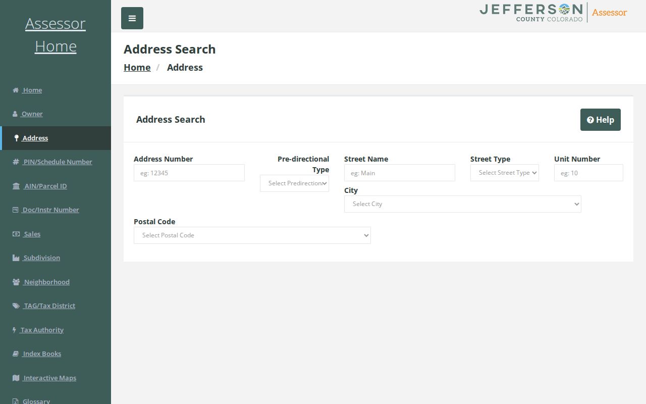
The address-form image helps explain why the direction, street type, city, and ZIP should be captured with the search result.
Map a Lakewood Parcel by Street
Jeffco jMap supplies property, parcel, street, address, hazard, planning, zoning, transportation, parks, and open-space layers. Lakewood eGIS adds parcel, address, building, zoning, historic, hazard, code, road, ward, and association layers. The Lakewood address service can expose PIN, parcel, street, ZIP, subdivision, block, lot, reception, census tract, school, district, and organization fields, subject to the service date and field definition.
Select one parcel, record the map or service date, and inspect the surrounding geometry. An eGIS REST query can support address, parcel, distance, order, statistics, and pagination parameters, but map data is not a land survey. A selected neighbor is an adjacent parcel, not proof of a neighbor’s occupancy or association membership.
For a visual starting point, use the Jefferson County GIS viewer before checking a Lakewood eGIS layer.
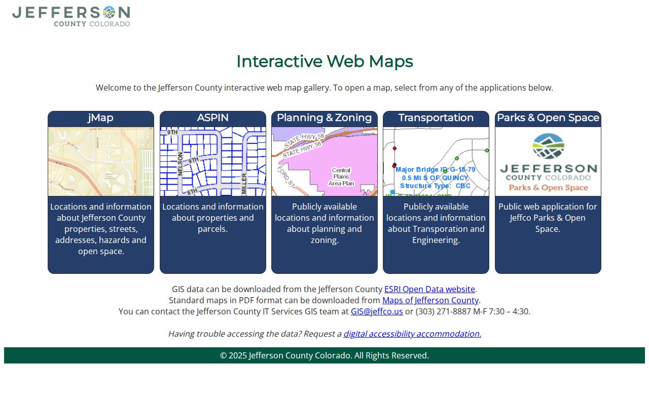
The GIS image belongs with the parcel step because the map gives geographic context that the assessor table does not.
Lakewood Address Records by Street
A Lakewood street directory works best as a set of linked record types. Each row below has a different custodian and a different claim. Use the parcel or legal description as the bridge, not a street name alone.
| Record set | Keeper | Street-level clue | Access |
|---|---|---|---|
| Assessor parcel | Jefferson County Assessor | PIN/AIN, owner, situs, mailing, class, building and sales lead | Public portal |
| Address and parcel map | Jeffco GIS and Lakewood eGIS | Parcel, block, lot, ZIP, ward, zoning, nearby geometry | Public map or REST layer |
| Recorded instrument | Jefferson County Clerk & Recorder | Grantor, grantee, reception, legal description, image lead | Public index; image behavior varies |
| Tax and foreclosure event | Treasurer and Public Trustee | Tax, lien, notice, cure, or withdrawal event | Public portal and office route |
| Permit or code matter | City of Lakewood | Project, address, applicant, contractor, inspection when public | eTRAKiT or request |
| Older address directory | DPL and JCPL | Householder, occupant, address, and locality lead | Digital or library access |
The voter lookup is deliberately not a street roster. Colorado Go Vote requires an individual first name, last name, ZIP, and birthday. Controlled voter products have separate request rules and protected-address limits. If the question shifts from a street to one person, use the Lakewood resident lookup workflow.
What a Lakewood Parcel Card Shows
The parcel card joins several identifiers. PIN, AIN, and schedule numbers point into county systems. Subdivision, block, lot, or a metes-and-bounds legal description connects the modern address to a recorded instrument. Building type, design, year, quality, construction, area, acres, builds, and units add property context when displayed.
- Situs
- The physical parcel location; it can differ from the mailing destination.
- Mailing address
- The destination for assessor or tax correspondence, which may be elsewhere.
- Plat
- A recorded map that can tie a subdivision, block, lot, and street to land.
- Criss-cross directory
- A street-order reference that leads from an address to a householder or occupant entry.
Keep the source date beside every field. A map layer can be older than a parcel card. The owner field can be stale, entity-based, or tied to a legal interest. The street directory should say what is displayed and what is only a lead.
Lakewood Deed Chain Along a Street
For each selected address, start with the current assessor owner and legal description. Treat sales history and reception numbers as leads. Search the current grantee in the Recorder’s Combined Name Search, capture the instrument and legal description, then search the seller as grantee. Repeat until the instrument or image coverage stops.
Jefferson County reports real-estate images online from 1859 forward, but the exact cutoff by instrument type and the public or paid image behavior were not located. A deed chain is strong when party names, reception number, recording date, subdivision or legal description, and parcel clues agree. A name-only hit is not enough.
The Jefferson County Real Estate Index shows the Combined Name Search route and Party Type field.
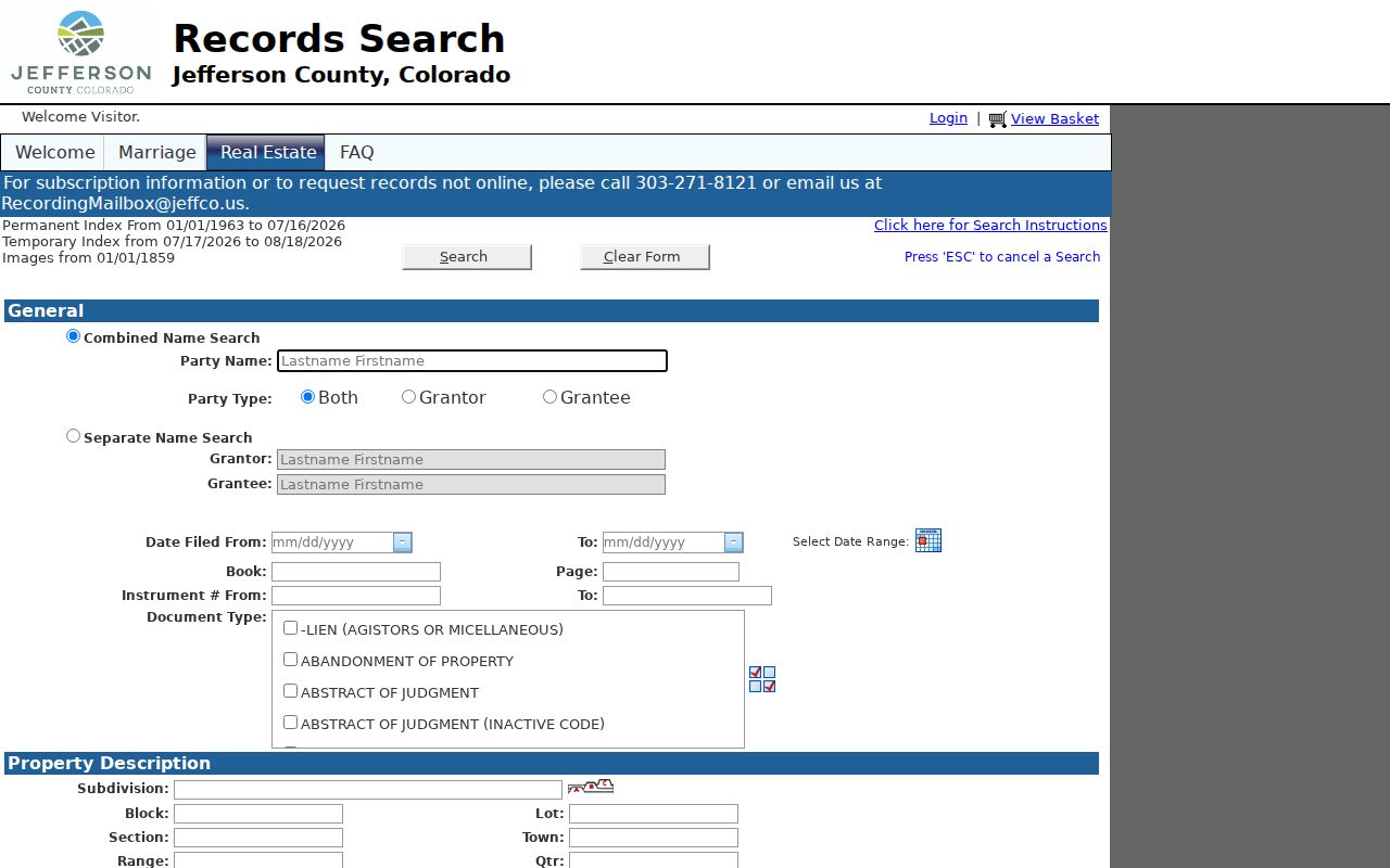
The recorder image is a useful prompt to capture reception, party role, date, document type, legal description, and image status before moving to the next grantor.
Lakewood Street Permits and Code Events
Lakewood’s building and construction page routes public permit work to eTRAKiT. Its public links include Search Permits, Search Projects, Properties Search, Inspections, Lakewood Licenses, and Code Violations. A result may show a permit or project number, address, applicant, contractor, inspection, or code matter when that field is public.
Historic permit coverage was not stated. The Permit Counter can be reached at 303-987-7500 and permitcounter@LakewoodCO.gov, while a city CORA request can name the property, date span, and record type. A permit event dates work or review. It does not establish current occupancy or a completed transfer.
Lakewood Street Tax and Foreclosure Events
The Jefferson County Treasurer search accepts owner, address, PIN or schedule, and AIN or parcel routes. Its result flow includes row details, a green cart, new-window links, and help. Tax certificates are not listed as a website product, so a question about a certificate or older tax material belongs with the Treasurer or Archives. Keep the tax year, parcel, named party, status, and search date.
The Public Trustee foreclosure search adds another dated event layer. Jefferson County says foreclosure documents can remain visible when a matter is cured or withdrawn. That status matters. A notice or lien is not proof that a transfer completed, and a tax record is not proof that a person occupied the situs. Use the Treasurer property search and Foreclosure Search as cross-checks after the parcel and deed identifiers are stable.
Lakewood ZIP and City Lines by Street
Postal geography can complicate a street directory. Lakewood’s nine associated ZCTAs include 80123, 80127, 80214, 80215, 80226, 80227, 80228, 80232, and 80235. The city spans ZIP areas shared with other municipalities. An address in 80227 can have a Bear Valley postal lead in Denver, while a 80214 address can point to Edgewater postal geography.
Use USPS for an exact delivery check, Census for a ZCTA approximation, and county or city GIS for the parcel and municipal context. A ZIP filter in the Assessor or Treasurer returns that portal’s records with a ZIP field. It does not return every person or every delivery point in Lakewood. The Lakewood ZIP Directory keeps the postal and city questions apart.
Older Lakewood Streets and Directories
Modern street strings are not enough for an older address. Jefferson County’s historical material notes that wooden street signs were replaced with metal signs in 1952. That is a map clue, not a verified citywide renumbering. No official Lakewood-wide readdressing or renaming list was located. Use the present parcel, plat, deed description, historical map, directory locality, and archive reference together.
DPL Householder and Criss-Cross material covers 1924 to 2018, with digital coverage reported for 1924 to 1937. Denver city directories cover other year spans and may or may not include a Lakewood entry. Read nearby entries and front matter for street changes, wards, abbreviations, and locality notes. The city-directory collections page owns the volume-by-volume shelf detail.
Lakewood Street Search Notes
Save the address filter, result maximum, page number, source date, and record type for a street study. If the assessor caps the view at 50 or lacks an export, say that the set is partial. A defined CORA request can ask for a dated address crosswalk, GIS layer, permit set, or metadata instead of asking an office to assemble a conclusion.
For each selected parcel, keep PIN or AIN, owner spelling, situs, mailing, subdivision, block and lot, reception lead, ward, precinct, ZIP, source URL, and confidence. This makes a Lakewood street directory repeatable while leaving the full named-street chain to the address workflow.
Lakewood Street Records That Stay Private
Some address-linked fields are intentionally outside a public street directory. Colorado DMV records are restricted by the DPPA and state rules. Utility billing identifies a customer account, not a public household roster. Protected voter addresses, Address Confidentiality Program records, juvenile and sealed court material, victim data, and restricted vital records may be withheld or appear absent.
Even a public owner or mailing field needs care. Do not infer a household from a parcel, a registered voter from a ZIP, or an association member from an eGIS organization attribute. If a source seems inconsistent, preserve both the source date and the uncertainty, then ask the original custodian for correction or clarification.
Lawful use. Address records in Lakewood are for personal, family-history, civic, and place research. Do not use a street trail to stalk, harass, intimidate, or harm anyone.